My photo
Albemarle, N.C., United States
A blog about (1) scenic trips and hikes in Randolph, Montgomery and Stanly counties and (2) historical information on the area and (3) land conservation efforts in the Piedmont area of North Carolina. Scroll to the bottom of this page to view my Web Links and Blog Archive. Also click on any photo below to enlarge.

Thursday, December 11, 2008

443 Pristine Acres Preserved and Protected


Tonight at the Guilford County Commissioner’s meeting the commissioners approved the purchase of the 250 acre Richardson tract off of Plainfield Rd. near Church St. for $2.56 million. (Click to enlarge map above.) The broadly supported decision by the commissioners, after one and a half years of hard work by the Guilford County Open Space Committee, ensures completion of our goal to preserve 443 acres of beautiful uplands and very sensitive wetlands that flow directly into Lake Townsend. This major project will protect and improve our water quality and our air quality. This project will provide significant protection for trees, plants, waterfowl and animals. This project helps to sooth the eye and the soul.

The State Of NC agreed on Nov. 4th to purchase the adjoining 193 acre Morton tract. The two tracts combine to preserve 443 acres. The state became very interested because the joint purchase of the two tracts provides most of the route for the Mountains to Sea Trail from the Greensboro Watershed Trials to the Haw River State Park. The Richardson family of Vicks Vaporub fame and the Morton family of Grandfather Mountain fame also gifted a significant part of their property for this major conservation project. To make this deal potentially sweeter the Open Space Committee will apply for a grant of around $1.3 million from NC Clean Water Management Trust Fund.

It was the Guilford County Open Space Committee that conceived and nominated the Haw River State Park in 2001 that now contains around 1500 acres and is growing. In 2006 and 2007 two additional tracts were purchased and preserved by the Open Space Committee and in 2008 we preserved seven new tracts. Not counting our important efforts at the Haw River State Park (that used only state funds) we have now preserved nine tracts of open space in Guilford County that total 725.5 acres. Of the $10 million Open Space Bond Funds approved in 2004 we have now spent (including the Richardson tract) $3.8 million. Over $6 million in funding still remains for additional projects in Guilford County. (Wake County voters overwhelmingly passed an additional $50 million open space bond in 2007 and in Mecklenburg County voters approved an additional $34 million.)

Friday, November 14, 2008

Photos of Morton Tract


Please note details just below of the Richardson/Morton and Mountains to Sea Project.
(Click on any photo above to enlarge it.)

Thursday, November 13, 2008

One Beautiful Project! Richardson/Morton Land Preservation and the Mountains to Sea Trail in Our Backyard


Back in May the N&R reported on the possible creation of a huge new land conservation project. The Richardson/Morton project created and brokered by the Guilford County Open Space Committee is now very close to becoming a wonderful reality for the citizens of Guilford County.

This project will help protect our community’s water reservoirs, help recharge our groundwater, and provide protection for air purifying trees and plant species. It will protect large beaver ponds, waterfowl and substantial numbers of other wildlife.

Thanks to efforts of all involved the cost for this important project was shared, gifted and reduced by all the players. With a price tag of initially over $6 million the Guilford County part of this will be no more than $2.56 million and possibly with a Clean Water Management Trust Fund grant as little as $1.5 million. We on the Guilford County Open Space Committee urge your strong support for this project and you can help by contacting the county commissioners.

More news articles should follow soon but these are some of the current facts about this project:

· The N.C. Division of Parks, the Guilford County Open Space Committee and the Guilford County Parks & Recreation Commission have all approved our parts of this project. The Board of Guilford County Commissioners at their Dec. 11th meeting at 5:30 p.m. in the Old Court House at 301W. Market St. should give final approval for this project.

· 443 pristine, natural acres of land will be preserved north of Lake Townsend, north just off Plainfield Rd. about one mile west from Church St., west of Spencer Dixon Rd., and running to the back of Northern High School property off of Hwy 150.

· This project will provide much of the land needed to connect our Greensboro Watershed Trails to the Mountains to Sea Trail section running between Greensboro and the Haw River State Park.

· The Morton family (of Grandfather Mountain fame) has agreed to sell, at 25% under the current appraised value, 193 acres at $2.82 million. And the N.C. Council of State just approved on Nov. 4th the purchase of this section of the Mountains to Sea Trail for the N.C. Division of Parks. Thus this entire 193 acre tract will be purchased by the State of N.C.

· The Richardson family (of Vicks Vaporub fame) has agreed to sell, at almost 40% under current appraised value, 250 acres at $2.56 million. This conservation land purchase (and use of this land in part for the Mountains to Sea Trail) will require the use of Guilford County Open Space bond funds that were approved by voters in 2004. And the use of county bond funds requires the approval of the BOCC.

· The Greensboro Parks & Recreation Department has agreed to partner with Guilford County and the State of N.C. to help maintain this section of the Mountains to Sea Trail.

· The Guilford County Open Space Committee will apply for a grant from the N.C. Clean Water Management Trust Fund to reimburse around $1.3 million of the $2.56 million that will be spent by Guilford County for this project. Since the Richardson tract includes significant wetlands along Long Branch that feed into Lake Townsend this is a very realistic possibility. Thus this entire project may only draw down the approved bond funds by around $1.5 million.

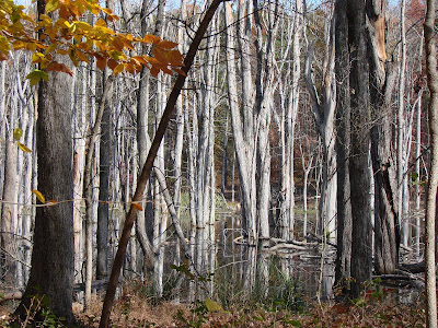
**Click on map of Richardson and Morton property and photos above to enlarge. 1st photo of beaver pond on Richardson property, 2nd photo of huge Willow Oak on Morton property and the 3rd photo is of a trail on the Morton property. More photos to follow.

Friday, October 31, 2008

Conserving Land for Everyone in Guilford County


The Guilford County Open Space Committee with approval of the county commissioners has now preserved six important tracts of land in Guilford County with voter approved open space bonds to help clean our water, recharge our water, improve air quality and preserve plant and animal habitats, etc.

Above are photos from the Bold Moon tract that was approved on 3/6/08. This tract includes just over 20 acres and one-half of the value of the property was gifted by the owners. It abuts Reedy Fork Creek off of Hicone Rd. in Gibsonville. It has huge rock outcrops, some over 18 feet tall. It has a historically significant old carriage path and stream ford. A real gem!

Friday, August 8, 2008

New River Smallmouth Bass


Several weeks ago I went on a delightful fishing trip on the New River just outside of Sparta. Jack Jezorek was our very knowledge host and Alex Ashton and I were the lucky guests. We barely found the time to discuss our land preservation work with the Guilford County Open Space Committee. Even though I have done a lot of lake, river, sound and backcountry fishing I had never wet a hook in the New River. I came away amazed at the very healthy population of smallmouth bass who cruse along the shady banks and stay tucked away under the many rock shelves waiting for food to float by in the mostly gentle current.


The water had just a little turbidity to keep the bass from being skittish. From either the canoe that held two of us or the kayak the water flow seemed to be perfect for our ten mile float trip on a sunny day without high humidity and with a gentle breeze.


Having spent most of my fishing time on a stable Florida Key’s flats boat or a bass boat this fishing from canoe, and later the kayak, initially felt a little unsteady but the river became a wonderful, embracing companion that pushed many smallmouth bass towards my four inch plastic worm. The canoe and kayak became stable with a little patience and practice.


The banks were alive the entire way with kingfishers, blackbirds, tons of magnificent song birds, duck, geese and at times grazing cattle. A few McMansions seized a high overview and one large development along the river looked like it had recently collided with the falling real estate market but for the most part that ancient river remains in the arms of pastoral landscape and forest.


At the end of the ten miles I had lucked upon around thirty-six bass who were all released back into the waters of the New River a few in the 16” and 17” category. I have at times beaten those numbers but I seldom enjoyed a fishing trip more. I’ll be back on that lovely water again.

Wednesday, July 9, 2008

Classic Guilford County Dairy Farm Has Been Saved

Wonderful news that the Gerringer Dairy Farm has been saved from development pressures and that the new conservation easement arranged through the Piedmont Land Conservancy, federal and state farm trust funds will provide money for the farm to remain an active dairy farm into future generations.

The Gerringer project was initiated by the Guilford County Open Space Committee; however, the use of conservation easements for several reasons was not sufficiently supported by the County Commissioners. Conservation easements are a very important tool for land preservation. Basically the Gerringer's are receiving almost 50% of the appraised value of their land because they are agreeing to never develop their property. They will be paid on the front end for the value of their development rights. Such a program is important to help family farms obtain some of their land value without selling their land to developers.

Wednesday, June 4, 2008

Linville Gorge Trip


Looking at the 540-million year-old quartzite rock that lies beneath the 745-million-year-old metamorphosed granite rock at the walls of the gorge is an amazing view provided by the unique geological window that is Linville Gorge.

Thanks to a fine new book Exploring the Geology of the Carolinas we have a geology field guide for our state. No doubt it is a treat to view the rocks of Linville Gorge and understand that the supercontinent of "Gondwana (which was made of parts of Africa and South America) collided with Laurentia" (North America) and that collision around 300 million years ago helped to form Linville Gorge.

More about some ancient rocks later but above is a wildflower photo of Blazing Star also called Devil's Bit. The gorge was loaded with Mountain Laurel and Rhododendron in full bloom.

Wednesday, May 21, 2008

Growing Interest In Land Preservation


I continue to be amazed at the quality and beauty of properties that have been recommended for preservation to the Guilford County Open Space Committee. Community interest is definitely growing and we are receiving more calls than ever from interested property owners. In many instances these property owners are so eager to preserve their tracts that they are offering them significantly below the appraised value. One recent owner is considering simply gifting their beautiful tract to Guilford County. Direct tax credits from the State of N.C. can provide some important benefits for below market value transactions and for land gifts to the county or state.

It is very impressive to work with property owners with land that has been in their family for several generations. Their commitment to permanently preserve their land becomes more important for them than receiving top dollar from a developer.

We have had two property walks this week that were simply stunning. One near Deep River in South West Guilford County and the other was off of Yanceyville Rd. that backs up to Lake Townsend. It seems like gradually the word is getting out about the work of the Open Space Committee and its very ambitious goal to protect 100 acres of park and open space per 1,000 residents of Guilford County.

In the last inventory of protected land in Guilford County we sadly found “that (only) 4.69% of the total land within Guilford County is currently protected by some form of government ownership or conservation easement. In other words, of the 417,308 total acres of land in Guilford County, 19,565 acres (including 5,308 of surface water) are currently protected."

We are perhaps in our last decade to still have access to important tracts for preservation. Our work over the next ten years is crucial. The $10million Open Space Bond approved in 2004 is the core of our funds for land preservation but we have been able to tag team with state funds and clean water trust funds to help that money go much farther. No doubt another bond will be needed for additional land preservation in several more years.

Sunday, May 4, 2008

Indeed This Land is Magical !

Taft Wireback's N&R article today broke the important story of the Richardson/Morton/Mountains-to-Sea Trail developing project just off of Plainfield Rd. and north of the Lake Towsend Watershed.

This developing project created by the Guilford County Open Space Committee could protect and preserve between 300 to 500 acres of beautiful land. Much like the Haw River State Park Project that was initially conceived by the Guilford County Open Space Committee this project should be significantly funded by the state because this land can be part of the state’s Mountains-to Sea Trail.

The Guilford County part of this possible $5 million project could turn out to be less than $2 million. That $2 million, if approved by the Guilford County Board of Commissioners, would come from already set aside Open Space Bonds that were approved by voters in 2004. The other key to this project is that as much as $1 million from those bond funds could be reimbursed to Guilford County from the Clean Water Management Trust Fund since this purchase would significantly protect the water quality of Lake Townsend.

Also in the early stages it appears that the two key property owners the Morton’s and Richardson’s may be willing to sell their land below the appraised value to make this entire project very attractive for everyone involved.

Like the Haw River State Park it is almost too good to be true! But it is all heading in the right direction with many loose ends coming together.

It will take broad community support and the approval of the Guilford County Parks & Rec. Commission and the Guilford County Commissioners to make this project become a reality.

And by the way while a lot of energy is centered on the northern area of the county the Open Space Committee is actively pursuing other open space projects in the southern parts of Guilford County including properties near Deep River.

Friday, April 25, 2008

Beautiful Open Space Still Exists in Guilford County


I am a fairly new member of the Guilford County Open Space Committee .

Above are two photos I took yesterday of the Baynes tract, off of Haw River Rd., that is a real gem. It contains a wonderful stream, tumbling water down steep rock formations, high bluffs and great wildlife and wild flowers.

The open space program was proposed by Jack Jezorek, Maxine Dalton, Bill Ross and several other folks in 1999. The Guilford County Board of Commissioners created the Open Space Committee in July of 2000 to act in an oversight role for acquiring open space in Guilford County. In 2004 voters in Guilford County approved a bond fund of $10 million to preserve open space.

Open Space is defined by the committee as "land in a predominantly undeveloped condition, including forests, wetlands, stream corridors, managed meadows and agricultural areas."

Some benefits of Open Space:
Protects water quality
Recharges ground and surface water
Improves air quality
Preserves plant and animal habitats
Offers low-impact recreation (hiking, birding,etc.)
Connects people with nature

The biggest success of the Guilford County Open Space Committee is the Haw River State Park. The Open Space Committee conceived the idea of a state park in Guilford County; officially nominated the Haw River corridor in 2001; and worked with the Guilford delegation to the General Assembly to pass House Bill 1025 for the park in 2003. Significant additional land is still being added to this developing park.

Several wonderful properties (including the Baynes tract above) have been purchased for open space in Guilford County with the selection and recommendation of the Open Space Committee, then with approval of the Guilford County Parks and Recreation Commission and with the final approval of the Guilford County Board of Commissioners.

Information should be available soon on the new, wonderful proposed Morton/Richardson project off of Plainfield Rd. If approved the state funded Mountains-to-Sea Trail should connect through this area and eventually allow hiking from downtown Greensboro to the Haw River State Park.

Swallowtail Butterflies


I took these pictures of Eastern Tiger Swallowtail males on a hike last week. They were having a puddle party and extracting nutrients from the moist, muddy edge of Lake Townsend. They had just emerged and their color was brilliant.


Tuesday, April 1, 2008

World's Oldest Living Longleaf Pine Down This Path In Weymouth Woods


Tree’s warning: Get ready for more dry spells By Taft Wireback
Staff Writer
Saturday, Mar. 22, 2008 3:00 am

Credit: News & Record
Evidence of wet and dry periods is in the growth rings.
GREENSBORO — The world's oldest living longleaf pine has spoken, and it has a disturbing message for residents of the Greensboro, Charlotte and Atlanta metros.

Research involving the ancient North Carolina longleaf suggests that if you think the current drought has been unsettling, just stick around a few decades.

Every century, the southeastern Piedmont from Georgia through the Triad averages one to two monster droughts lasting four years or more, according to the tree and the man who discovered it, UNCG graduate student Jason Ortegren.

That should come as sobering news to parts of the North Carolina Piedmont, including Greensboro, that have seen their water supplies severely tested in the past decade by droughts lasting a year or two.

"So you can imagine the impact a four-plus-year drought would have," said Ortegren, who found the ancient pine last year with UNCG geography professor Paul Knapp. They discovered the tree at Weymouth Woods Sandhills Nature Preserve near Southern Pines while Ortegren was doing research for his doctoral dissertation, which he is now wrapping up.

Ortegren's tree research did unearth a silver lining, however: The region seems to have a built-in brake that, so far, has protected it from ever reaching conditions like the Great Plains "Dust Bowl" of the 1930s.

Nature's drought brake? Hurricanes and tropical storms that sweep across the region periodically, bearing the gift of abundant rainfall.

"I call them drought busters," Ortegren said.

North Carolina's ancient longleaf dates to at least to 1548. Ortegren and Knapp "cored" the tree, harmlessly removing a small-bore plug from deep within the trunk to disclose the year-by-year weather conditions under which it has lived.

The evidence is displayed in the tree's structure of annual growth rings. In layman's terms, each wide ring represents a year with sufficient or abundant rainfall; a very narrow ring suggests a year of drought.

Ortegren detects a hurricane or powerful tropical storm when he finds a series of multiple, very narrow rings followed by an unusually wide band of yearly growth.

The region suffered one confirmed monster drought in the 20th century, from the early 1920s through 1927, and one borderline bad actor during the mid-'50s. According to Ortegren's tree-ring evidence, droughts of greater than four years also occurred during periods ending in 1699, 1750, 1801, 1819 and 1882.

He has combed the historical record and found reliable reports of tropical storms ending droughts in 1882 and 1927. Longtime Greensboro residents know the city was in bad shape in 1954 until Hurricane Hazel swept through and replenished its depleted water supply.

Ortegren spent weeks meticulously examining the core from the Weymouth Woods longleaf. Then, as part of his doctoral project in UNCG's geography program, he compared its data with that from other very old trees to develop a picture of rainfall and drought from 1690 through 1984.

Ortegren couldn't go back any further in time because not enough trees had lived as long as the Weymouth Woods specimen. He used trees cored and analyzed by other scientists across the Piedmont from Georgia through Virginia.

The number of trees spread across such a large area showed periods of broad-based regional drought in five-year snapshots. He eventually built his case on data from just one of those aged trees, in Georgia, because it best represented the entire group.

But North Carolina's 460-year-old longleaf and data from the other ancient trees gave him the basic information that revealed and verified the long-term trends, Ortegren said.

Tree-ring research is valuable because it can extend some amount of weather knowledge to periods earlier than 1900, when people began compiling records that can be relied upon with scientific precision.

Ortegren found it surprising that his work could be groundbreaking, that this type of research marrying tree data to long-term weather patterns apparently hasn't been done for such a populous region. The aim is to capture patterns that the climate repeats over cycles of decades and centuries so people can get a better idea what the future might bring.

"These are things we need to keep in mind when we're laying out our plans on how to further develop this region," Ortegren said. "We need to think about where our water resources are going to come from in the event one of these severe droughts occurs, which seems like something we can expect."

Ortegren's basic conclusions are valuable in driving home the point that Greensboro is vulnerable to periodic dry spells and must be vigilant about its water supplies, said Allan Williams, the city's director of water resources.

"Our reliable data only goes back to 1928," Williams said of the city's lake records. "We don't really know what happened before that. I think he's putting a scientific and statistically valid imprint on something we've been saying for a number of years."

Ortegren theorizes that through the centuries, the Piedmont's cycles of wet, dry and super dry have been driven by as-yet undefined variations in the El Niño and La Niña phenomena, alternate cycles of warming and cooling in the Pacific Ocean that influence how much rainfall the Southeast gets.

The Holy Grail for Ortegren is to reach a point where scientists can define that unknown wrinkle, some telltale event or alignment of stars that provides an early warning the region is about to experience a monster drought.

But just knowing what has happened repeatedly in the past is a start toward understanding the future, Ortegren said. So residents can take heart that El Niño and La Niña seem to insulate them from droughts of desert-making intensity.

"But we don't seem to be safe from the recurrence of the four-year-plus drought," he said. "And that still could have a devastating impact."

Contact Taft Wireback at 373-7100 or taft.wireback@news-record.com


Pilot Mountain Trip


The drive into Pilot Mountain from Stokes County helps keep this entire trip very scenic from start to finish.

Thursday, February 21, 2008

Uwharrie Mountains


On Saturday, Feb. 16th we made a wonderful journey to the Uwharrie Mountains. The trip starts becoming really scenic as we turned off Hwy. 49 a little west of Asheboro onto Bombay School Rd. After a few more turns the ancient Uwharries, perhaps the oldest range in the U.S., begin to show their battered shoulders.

The Uwharrie Mountains may have originated around 500 million years ago with peaks higher than 20,000 ft. Today they try hard to reach 1,000 ft. above sea level. Some newer evidence indicates that the Uwharrie Mountains were probably connected to a super continent and broke away from what is now Africa. They, along with much of what is now the Eastern section of the U.S., gradually slammed into and formed North America.

The Uwharrie Mountains became a national forest in 1961 during the administration of President Kennedy. These mountains and especially their unique deposits of rhyolite, fine grained volcanic rock that made excellent spearpoints and tools, became very important to Native Americans around 9,000 B.C. Ancient Indian tools from Morrow Mountain rhyolite deposits have been found from Maine to Florida.